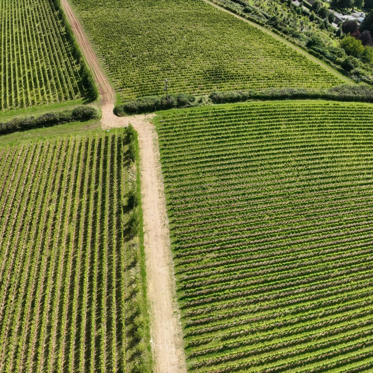
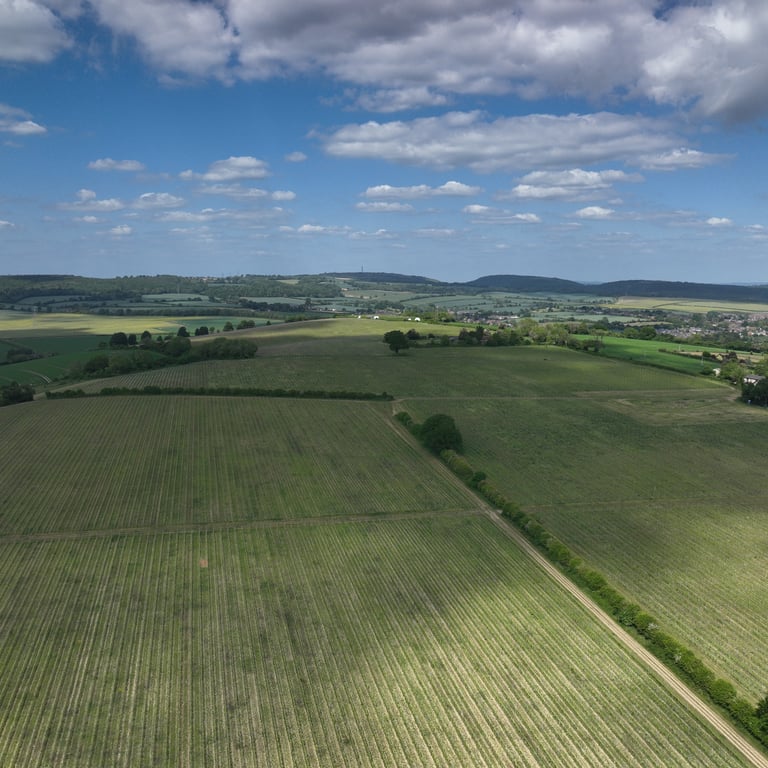
Vineyard mapping for Precision Viticulture
As you do, we believe vine health is critical in creating the perfect wine. Grapes are monitored closely throughout the season, but wouldn't it be great to get an even closer look? To see what's under the skin? Think of it as a health check for your vineyard!
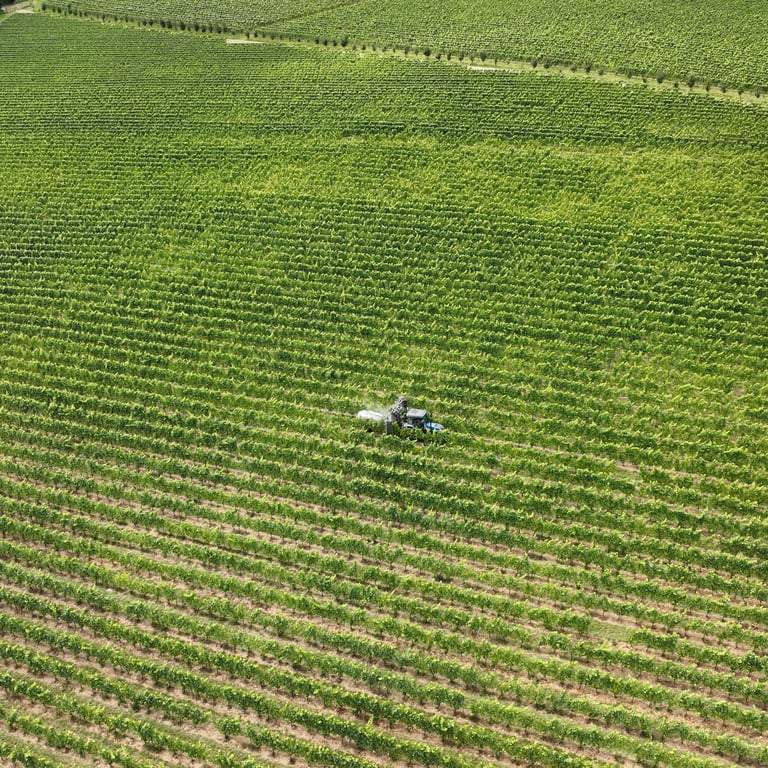
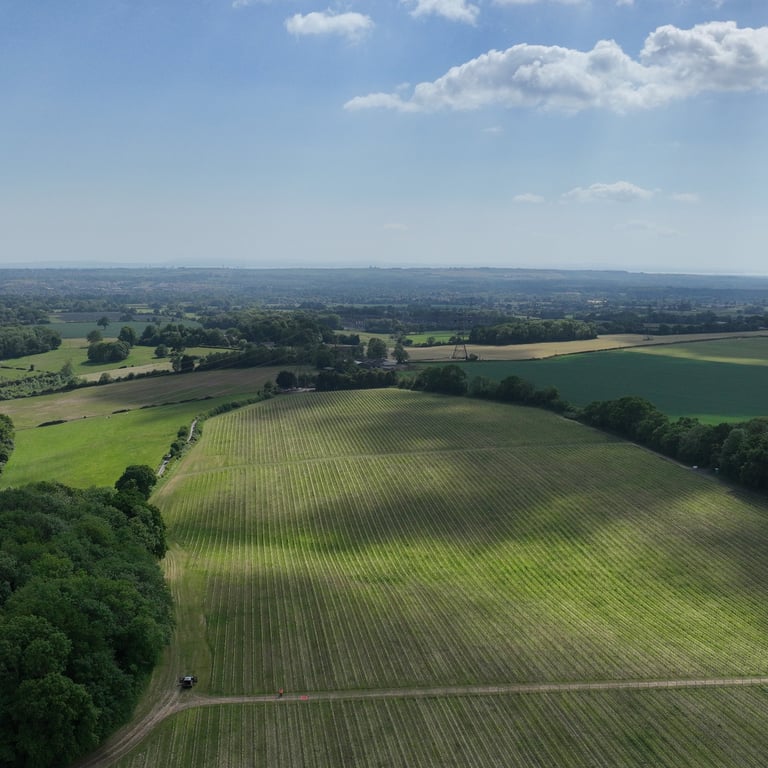
As a service provider to Viticulture we use cutting edge technology to work closely with vineyards, offering multispectral drone surveys of the vine to provide that extra level of data and insight through detailed reports and imaging.
This assists the Vineyard Manager or Head Winemaker to make rapid and effective decisions.
Testimonial from Louis Pommery England
"We were delighted with the drone mapping that Low Altitude was able to do for us over the growing season. It gave us invaluable insight into the health and functioning of the vines in real time and allowed us to fine-tune our precision viticulture by detecting strong areas or any issues before they became visible to the naked eye.
Their quick processing of results enabled us to ground truth the data, improve our decision-making, and proactively tweak our vineyard management accordingly. We look forward to continuing our relationship with Low Altitude in the future"
Will Perkins, Head Winemaker
Louis Pommery England
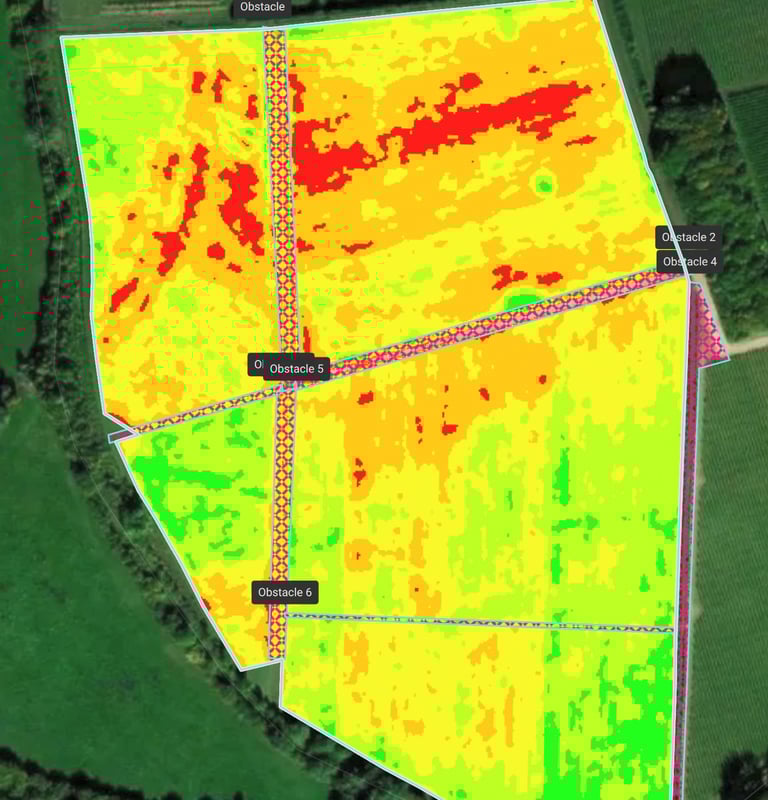
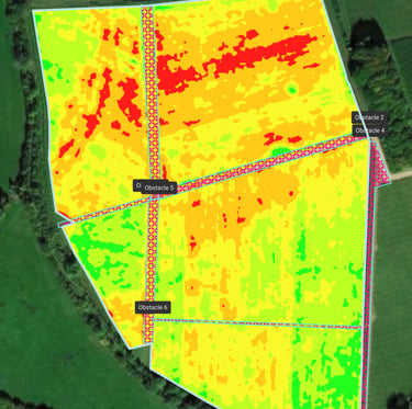
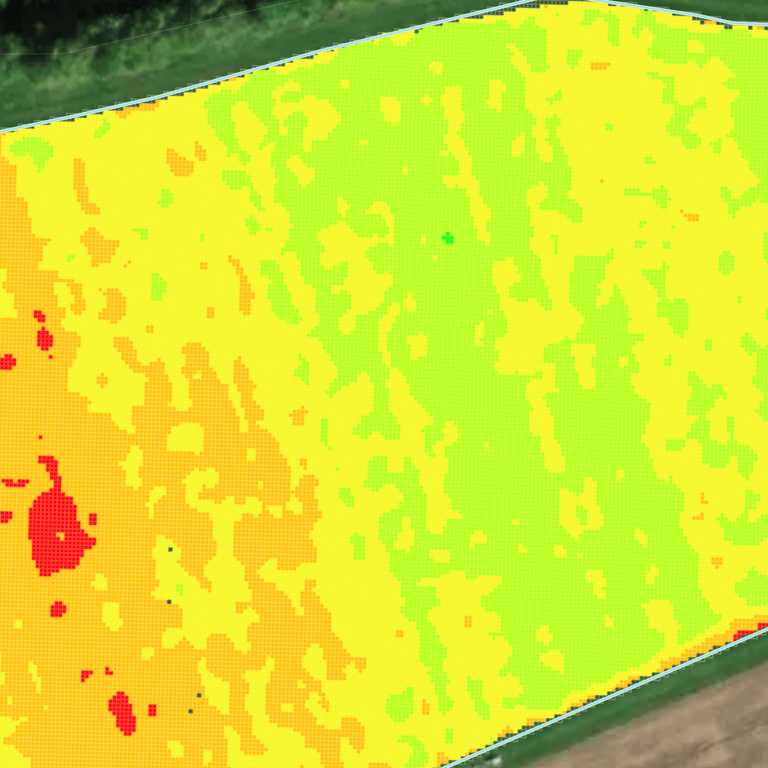
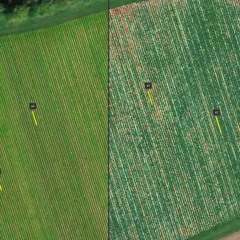
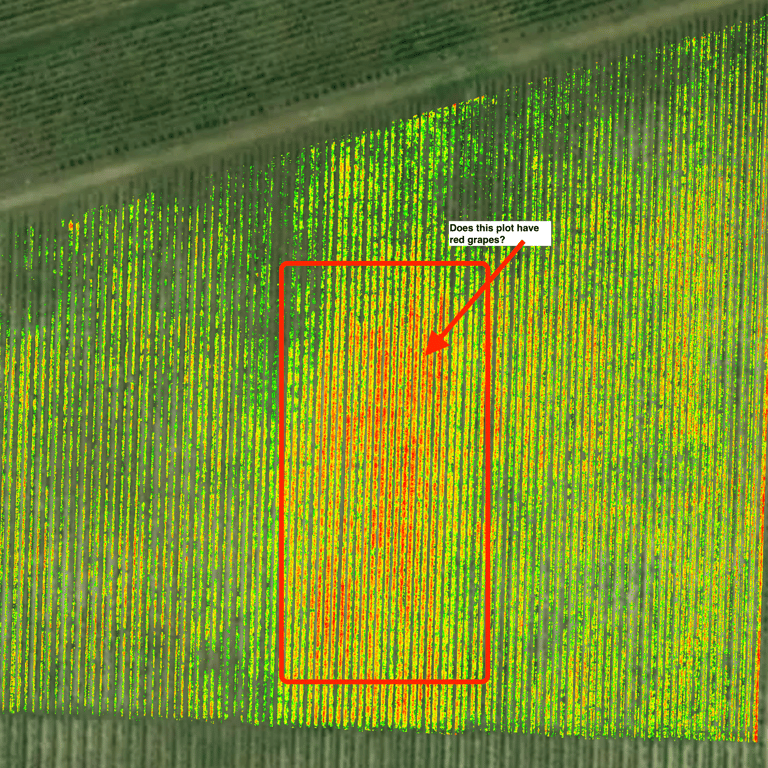
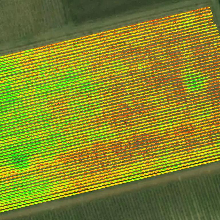
What is Multispectral Imaging?
Plants naturally reflect light in differing degrees, depending on chlorophyll absorption. Multispectral sensors view light in the normal visual range that our eyes can see, as well as additional bands that are invisible to us, such as near-infrared. By measuring the canopy reflectance values we are able to reliably detect stressed vegetation before it becomes visible to the eye; often around 3 days beforehand!
Multispectral images are processed through a range of vegetation indexes, which give clear insight into vine stress or photosynthetic activity. Surveys can detect the early onset of disease such as Powdery Mildew before it spreads to the rest of the crop. Images are further complimented by satellite data layers indicating water content, providing yet deeper insight into vine health.
As a drone can cover a lot more acreage in a shorter period of time than traditional scouting, you save time and cost by reducing the need for visual inspection of every row. Areas of interest can be targeted for a 'boots on the ground' view of a specific area highlighted by the drone report. Further savings can also be made through the application of water or fertilizer to drone-targeted, GPS marked areas; great for your bottom line as well as the environment!
Monthly surveys enable growers to constantly monitor their vineyard health and protect future yields.
What is the service?
• Mission planning
• RTK enabled Survey flight(s)
• Post processing and analysis
• Comprehensive PDF report with highlighted areas of interest
Results
It's critical to receive the results in a timely manner, so that you can take any action you deem needed based on the post-survey analysis. Therefore, we will normally provide results within 36 hours; in most cases the results are actually provided within 24 hours!
How much does it cost?
Vineyard mapping surveys are competitively and simply priced to enable integration with your current management processes. Choose a one-off survey to obtain a 'current state', or opt for monthly monitoring surveys across the growing season. With no monthly subscriptions, you are truly in charge of your costs.
We charge a 'per site visit' rate of £260 plus a low 'per acre', depending on level of detail required. We provide surveys across the South, including Hampshire, Dorset, Wiltshire, West and East Sussex. Please contact us for a specific quote.
Multispectral crop health surveys for vineyards: Explanation

Call us on 02382 146615
Email us at hello@lowaltitude.co.uk
Low Altitude Ltd
Hampshire Wiltshire Dorset Sussex
CAA Operator ID: GBR-OP-9VK7SHBYWQVW
Chief Pilot Flyer ID: GBR-RP-RMZFRWLH8QD7
CAA Operational Authorisation held
Copyright © 2026 Low Altitude - All Rights Reserved.